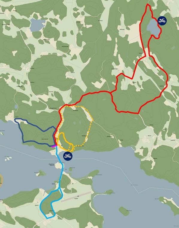
Around Stegeborgsgården there are good opportunities for hiking, on your own or along a marked path. The following joints are marked out.
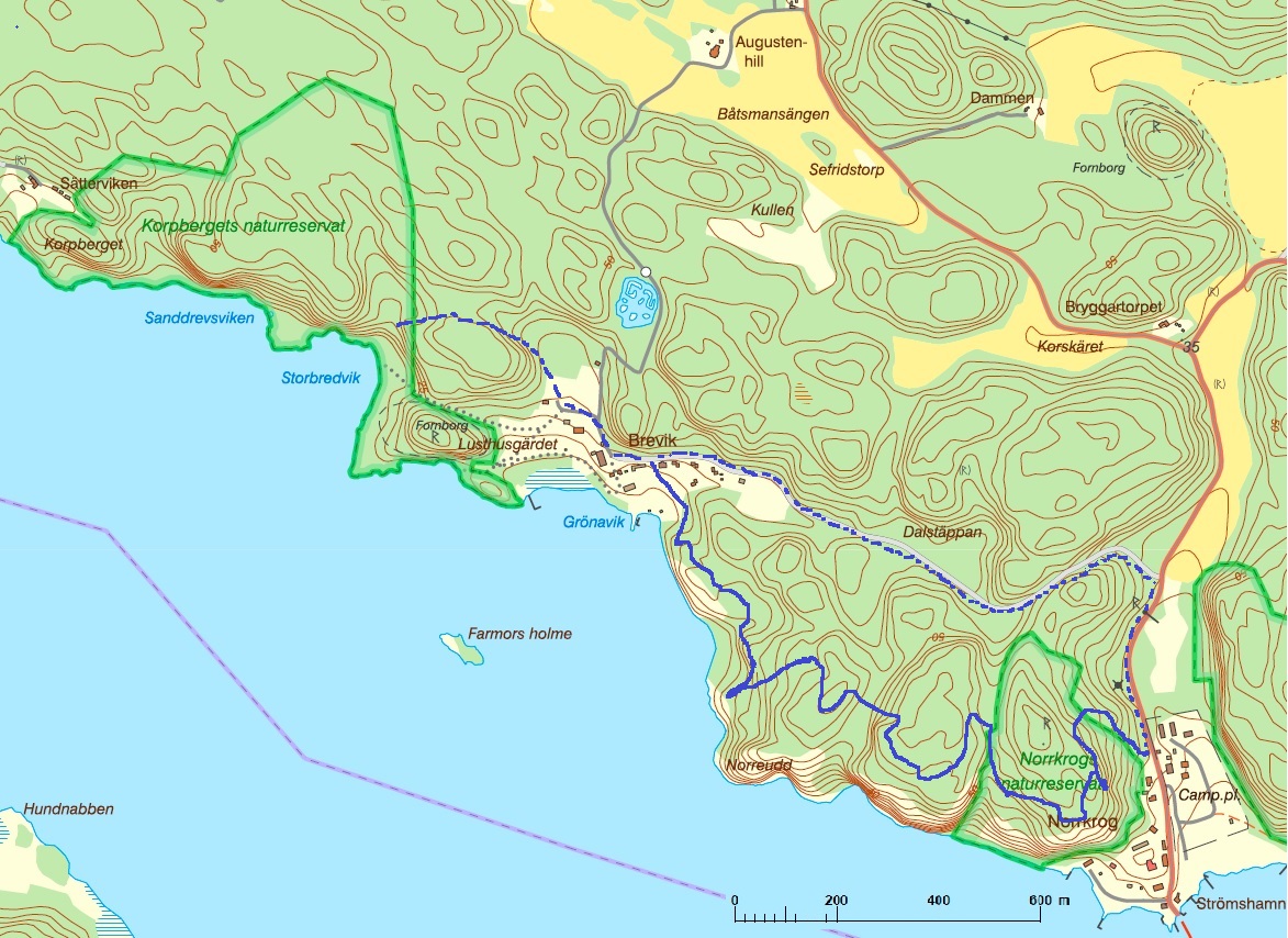
Overview map
Overview map
The information above, which summarizes the paths around the farm with a map and description, can be found in a printable folder that you can find here:
Paths and trails Stegeborgsgården (swedish) >
County Administrative Board information about Norrkrog nature reserve: Click here >
You can read Björn Esping's description of Lilla Kungsleden and Norrkrog nature reserve here >
The lookout point/Devotional mountain
■ The lookout point/Devotional mountain
Starting opposite Stegeborgsgården's garden service, see sign by the road, opposite the small Torpet. Västra berget offers a hike of about 15 minutes up to the viewpoint, from where you can look out towards Slätbaken's inlet and the inner archipelago. A great place for recreation and meditation.

Small Kings trail
■ Small Kings trail
Starting in the oak forest at the scout site in the top corner of Stegeborgsgården. Above the Ark church. The eastern mountain houses the Norrkrog nature reserve with several unusual plants and small insects. Up that mountain goes the Lilla Kungsleden, a hiking trail that takes about an hour to walk, but we recommend that you set aside at least two hours and bring a coffee basket to enjoy the nature and the view at one of the three viewpoints. From this mountain you can see inwards across the bay where Slätbaken eventually turns into Göta Kanal and outwards towards Sankt Anna's Archipelago. The trail ends at the beach (for the adventurous, you can take a shortcut in the gorge down to the beach).
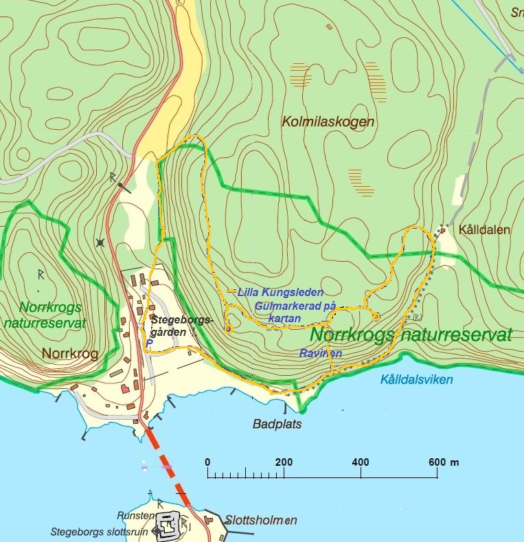
To Raven mountain nature reserve via Brevik
■ To Raven mountain nature reserve via Brevik
Approx. 2.5 km single road. The nature trail initially follows the path up to Utsiktplatsen, starting opposite Stegeborgsgården's garden service. Follow the sign to the right before the viewpoint and then the orange marking. The area is strongly hilly with heathland stable forest. Towards Slätbaken, the pine forest thins out in some places and opens up a beautiful view. Spruce, oak and aspen grow in depressions and ravines. Even the highly endangered ash is found somewhere. The trail goes over cobblestone fields, past badger pits and when you pass Brevik's camp you reach the Korpberget nature reserve and its trails. An alternative for returning to Stegeborgsgården is to take the road from Brevik - a more relaxed walk through the forest.
Stegeborg trail
■ Stegeborg trail
From Stegeborgsgården, you follow the Östgötaleden markings along the road north, a hiking loop of about 15 km. The hike follows the Östgötaleden to some extent and passes the small Skirsjön, which invites you to bathe from the rocks. Recommended time consumption approx. five hours. Follow the country road with the Östgötaleden marking - then turn left onto the forest road at the Ingelstorp sign. Be careful here, the signs can be a bit difficult to see. The road ends at a dilapidated lodge. Here begins the slightly tougher hike through the forest. Pass Skirsjön with its clear water. When you have passed Skirsjön and further out of the forest, you come out on a small road. You follow it to the left and on past Lönsås, an old farm with a deed of gift from Queen Kristina. Cross the barnyard back south. The way back goes through forest areas and grazed pastures. Follow the road at all times. When you come out to the T intersection, follow Östgötaleden to the right and you will soon be back at the starting point again.
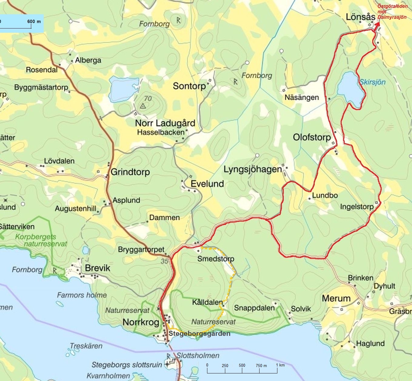
Stegeborg trail
■ ■ Stegeborg trail combined with the small Kings trail
(About 3.7 km). Follow the Stegebrogsround to Smedstorp where you turn in and follow the road until it splits. Keep right, get past the roadblock. When the forest opens up and Kålldalen, a red croft, is visible straight ahead, you will find a small tractor road that leads into the right of the crest. Follow it and jump over the ditch. So you go around and past the croft. At the height of the croft, the Lilla Kungsleden comes down from the mountains - you should walk on it. Follow the orange markings on the trees. The path leads into the Norrkrog nature reserve and offers a fantastic view of Slätbaken! The path goes up the mountains in parts and sometimes right down to the water's edge. Here you are met by fantastic mountain formations and a small cave and beautiful oak forest. The trail ends at the beach.
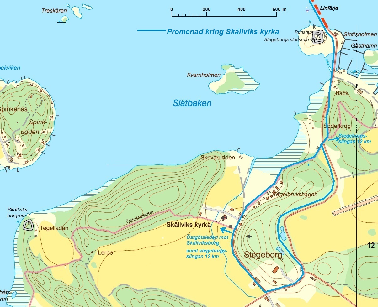
Walk around Skällvik churck
■ Walk around Skällvik church
(About 3 km). Take the road ferry across to the south side of Slätbaken. Follow the road past the harbour, over the small bridge to the mainland. Soon a path and cycle path will start on the left. It takes you back across the road, around to Skällvik Church and continues through Stegeborgs Estate, past the castle and the Garden Hotel along a lovely avenue with a view of the airfield and a lovely view of Slätbaken. Soon you are back where you started and can return with the ferry.